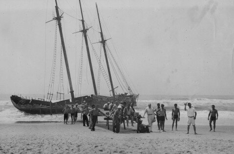
 Ocracoke
Lighthouse
Ocracoke
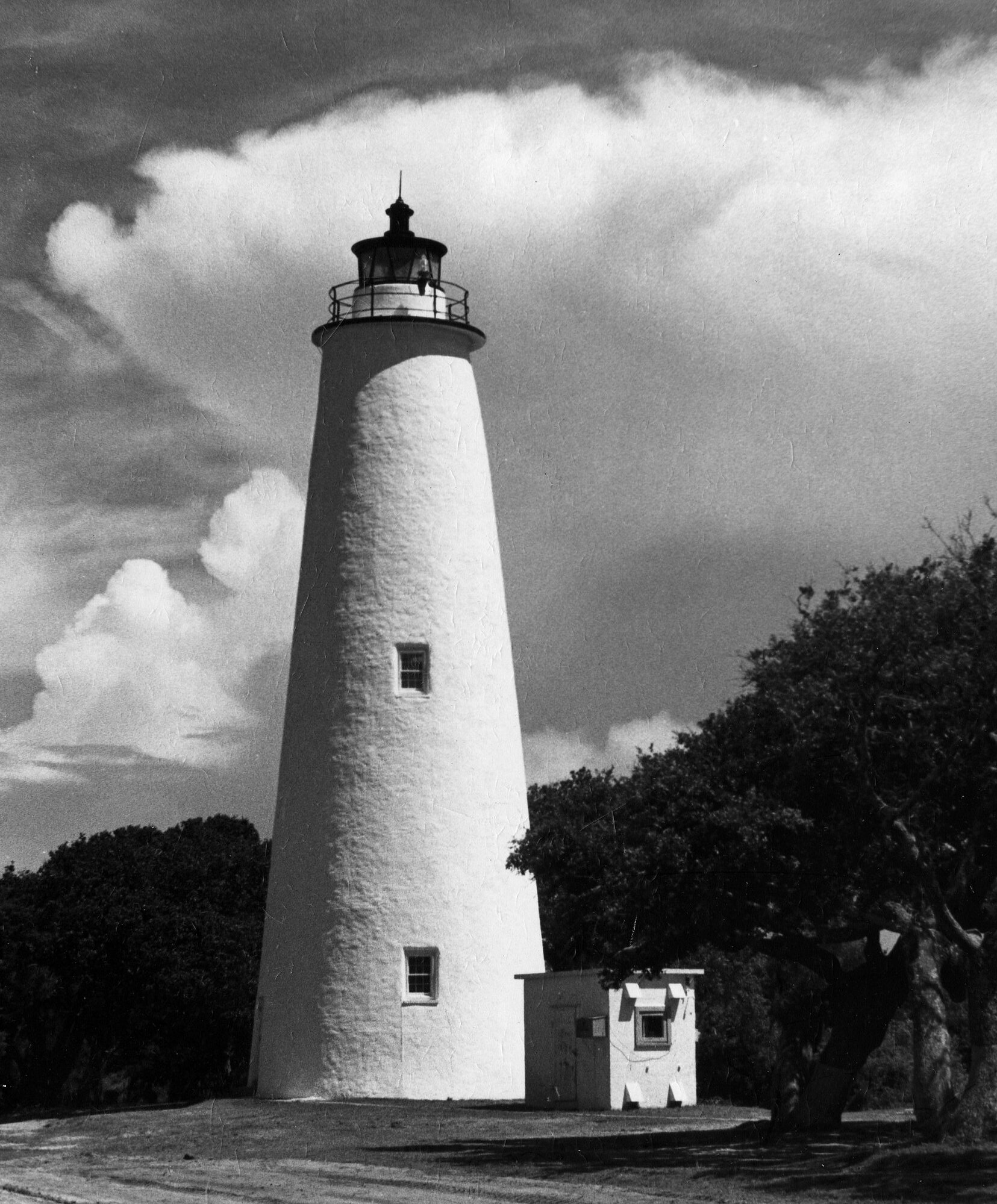
LighthouseOne of the best-known
old style brick towers is the lighthouse at Ocracoke village on North
Carolina’s Outer Banks. Winslow Lewis lost the contract for this 65-footer
to Noah Porter, another New Englander. Porter’s work, completed in 1823,
has held up well over the years. The photo shows the two most characteristic
features of the old style design. The tower is bluntly conical, and the lantern
is somewhat off-center because it is positioned over the top of the spiral
stairway. The original birdcage lantern is gone, replaced by a
mid-nineteenth-century lantern having distinctive trapezoidal windowpanes. The
lantern was designed for a fourth order Fresnel lens installed in 1854; this
lens was replaced with another fourth order optic in 1895, and that lens remains
in use today. The tower’s brickwork was later covered with a stucco-like
mortar, painted white. Several other old style brick towers have received
similar treatments.
Origin of The Name
(The
following history is reprinted with permission from the East Carolina
University’s Ocracoke History website)
The exact derivation
of the name “Ocracoke” is unknown, though many suggestions have been
made. It has been suggested that the name is linked to the Algonquian word
“waxihikami” which means enclosed place, fort or stockade. On old
maps, the spelling varies from Wokokon, Woccocon, Occacock, Ocacoe, Ocacock,
Occacock, Ocreecock and now Ocracoke. A more far-fetched suggestion is that
Blackbeard the Pirate, waiting for the fateful dawn of November 22, 1718, prayed
in vain “O Crow Cock! O Crow Cock!” in hopes of escaping his
pursuers. A good primer on island names can be found at Philip Howard’s Ocracoke
Newsletter Website.
 The Outer Banks along the coast of North Carolina is a
string of islands defined by inlets connecting the Atlantic Ocean on the east
with the sounds which extend in places as much as thirty miles westward toward
the mainland. These inlets have shifted over time; some have closed entirely,
new ones have opened, some have migrated along the islands and their depth
continually changes due to the vagaries of weather and current (Newell 1987:1).
The shifting depth and width of these inlets hindered maritime activity. Only a
few of the many inlets were deep enough to admit the passage of moderate-sized
vessels into the sounds. These inlets included Roanoke, Currituck, Topsail and
Ocracoke. Roanoke and Currituck were frequently used during North
Carolina’s early history, but became too shallow to admit any but the
smallest vessels by the 1730’s. Topsail Inlet had achieved some importance
by this time, but poor transportation connections with the interior limited the
growth of its commerce. With the exception of the region served by the Cape Fear
River, much of the colony’s commerce was channeled through Ocracoke Inlet
(Newell 1987:1).
The Outer Banks along the coast of North Carolina is a
string of islands defined by inlets connecting the Atlantic Ocean on the east
with the sounds which extend in places as much as thirty miles westward toward
the mainland. These inlets have shifted over time; some have closed entirely,
new ones have opened, some have migrated along the islands and their depth
continually changes due to the vagaries of weather and current (Newell 1987:1).
The shifting depth and width of these inlets hindered maritime activity. Only a
few of the many inlets were deep enough to admit the passage of moderate-sized
vessels into the sounds. These inlets included Roanoke, Currituck, Topsail and
Ocracoke. Roanoke and Currituck were frequently used during North
Carolina’s early history, but became too shallow to admit any but the
smallest vessels by the 1730’s. Topsail Inlet had achieved some importance
by this time, but poor transportation connections with the interior limited the
growth of its commerce. With the exception of the region served by the Cape Fear
River, much of the colony’s commerce was channeled through Ocracoke Inlet
(Newell 1987:1).Revolutionary Period
Throughout the American Revolution, British vessels and
privateers made numerous raids at Ocracoke Inlet, with several attempts to
blockade the inlet against all vessels sustaining the Patriot cause. These
activities led to the establishment of American land and naval forces at the
inlet, which continued to serve as a crucial artery of supplies until the
struggle for independence was won.
War of 1812
Throughout the War of 1812, Ocracoke Inlet served as a
base of operations for privateers and as an important avenue for supplies bound
for southeastern Virginia through the “back door.” An enemy attack
on the area had been feared since the beginning of hostilities, and in the
summer of 1813 the British made their appearance in considerable force: At
daybreak, July 12, the residents of Portsmouth, Ocracoke and Shell Castle awoke
to find a formidable British fleet anchored just off the Bar, including nine
large war vessels. Barges soon put off from the ship – one observer
counted nineteen barges, each carrying forty men – and when they entered
the inlet they attacked two American privateers, the Anaconda and the Atlas, and
a revenue cutter, capturing the privateers and forcing the cutter to retreat up
the sounds. Then the British troops landed at Portsmouth and Ocracoke, collected
hundreds of cattle and sheep, and after five days on the Banks weighed anchor
and sailed away, announcing before their departure that the entire coast of
North Carolina was under blockade (Dunbar 1958:39,150). Admiral Cockburn,
commander of the British naval force, had initially planned to proceed up the
Neuse River and capture New Bern. The escape of the revenue cutter to New Bern,
however, removed the necessary element of surprise, and the proposed attack was
abandoned. This was to be the only British incursion into the area of Ocracoke
Inlet. When hostilities ceased, attention was directed toward methods of
improving the inlet as an artery of commerce (Dunbar 1958:39).
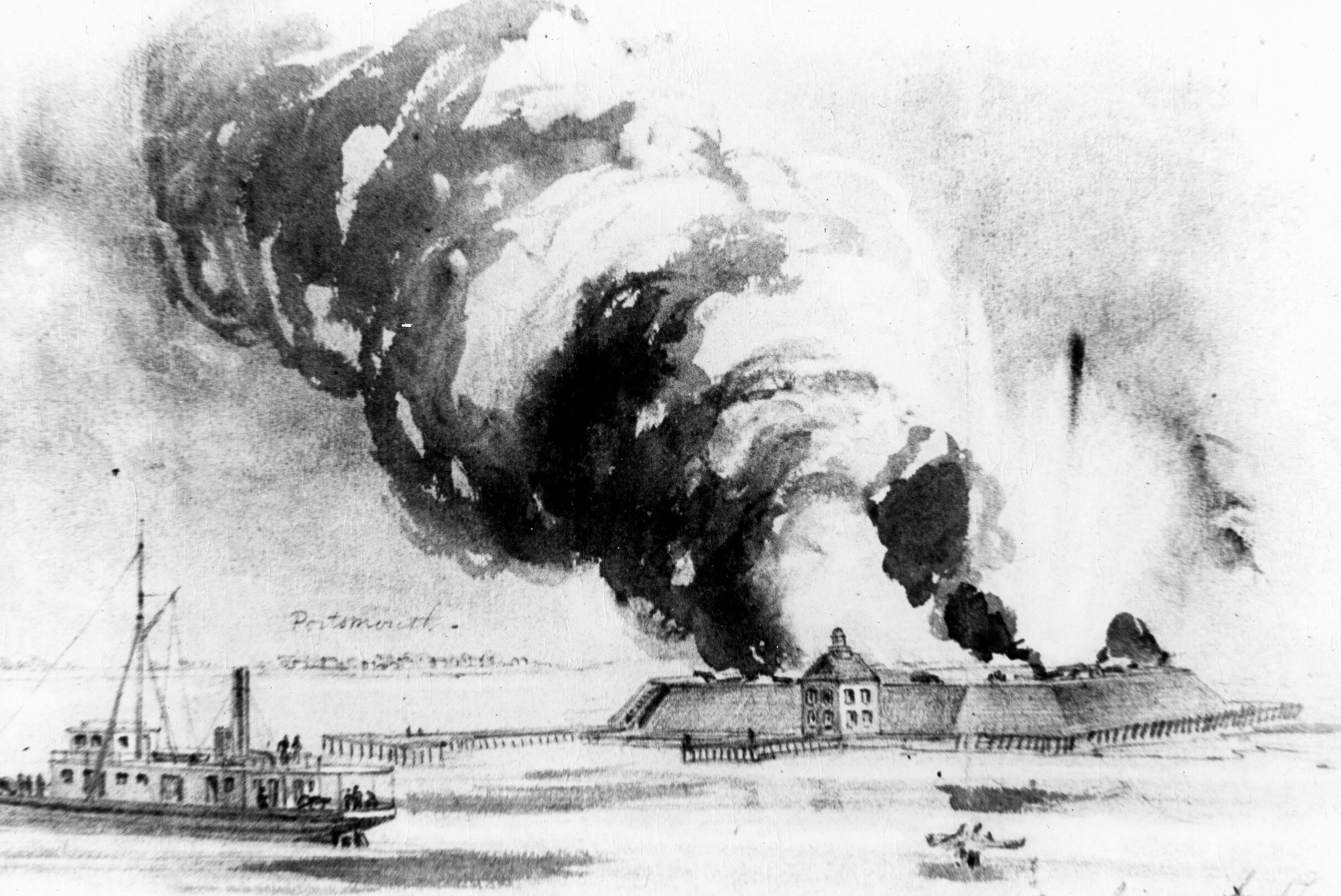 Civil
War
Civil
WarSoon
after the outbreak of the Civil War, Confederate forces seized the existing
forts along the coast of North Carolina and began construction of additional
fortifications on Roanoke Island and at Hatteras, Oregon and Ocracoke Inlets.
The Ocracoke facility was situated on Beacon Island, where an earlier
fortification had existed during the War of 1812. Of octagonal shape, the Civil
War installation was known alternatively as Fort Ocracoke or Fort Morgan. In
addition to a garrison there, it was reported that several hundred troops were
stationed at Portsmouth and on the beach below Ocracoke Inlet. All told, there
were about 500 Confederate troops in the area (Rush 1914:80). For more
information on Fort Ocracoke and during the Civil War, please check out the
SIDCO site
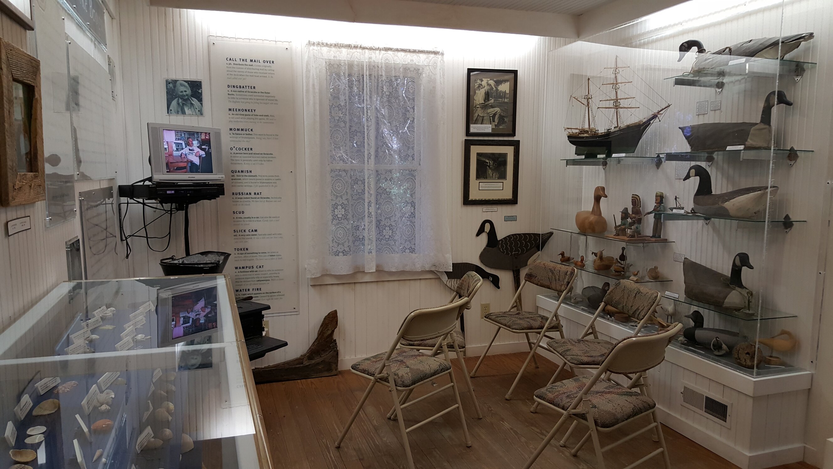
Ocracoke Brogue
Because of its
isolation, Ocracoke speech patterns have taken on a unique dialect, or
“brogue“, and
expressions over the past 250 years. Ocracoke brogue is the famous local
dialect. To some of the native islanders, there are only two kinds of people in
the world: O’Cockers and dingbatters (natives and non-natives,
respectively). For more information, click on the link above which will take you
to the Ocracoke Linguistics site of the North Carolina Language and Life Project
at the North Carolina State University.
Brogue Room
The
permanent exhibit in the OPS Museum, complete with continuous play video,
reflects the on-going research of Walt Wolfram, a North Carolina State
University linguist and self-described “wampus cat” (that’s
O’Cocker for someone abnormal!).
 Ocracoke Inlet
Today
Ocracoke Inlet
TodayThe
existence of the Navy and Coast Guard installations on Ocracoke during World War
II brought numerous servicemen from outside the area and had an invigorating
effect on the local economy. Ocracoke prior to the war was seeing approximately
3,000 visitors each summer to fish and swim, while another 500 visitors flocked
to the island each fall and winter for duck hunting (United States Congress
No.325:6). The establishment of Cape Hatteras National Seashore in 1953 brought
a steady flux of outsiders. Restricting the flow of tourists were the
difficulties in reaching the island and the lack of roads on the island itself.
These impediments were eliminated in 1957 with the creation of the state’s
establishment of year-round, toll-free ferry service across Hatteras Inlet, and
the completion of a paved road between Ocracoke Village and the ferry
terminal.
Since 1953 all of Ocracoke Island,
with the exception of Ocracoke Village, has been under federal ownership as a part
of the Cape Hatteras National Seashore, administered by the National Park Service.
The island remains unspoiled and in its natural state, the only improvements being
the state road and about ten miles of sand-fence barrier.
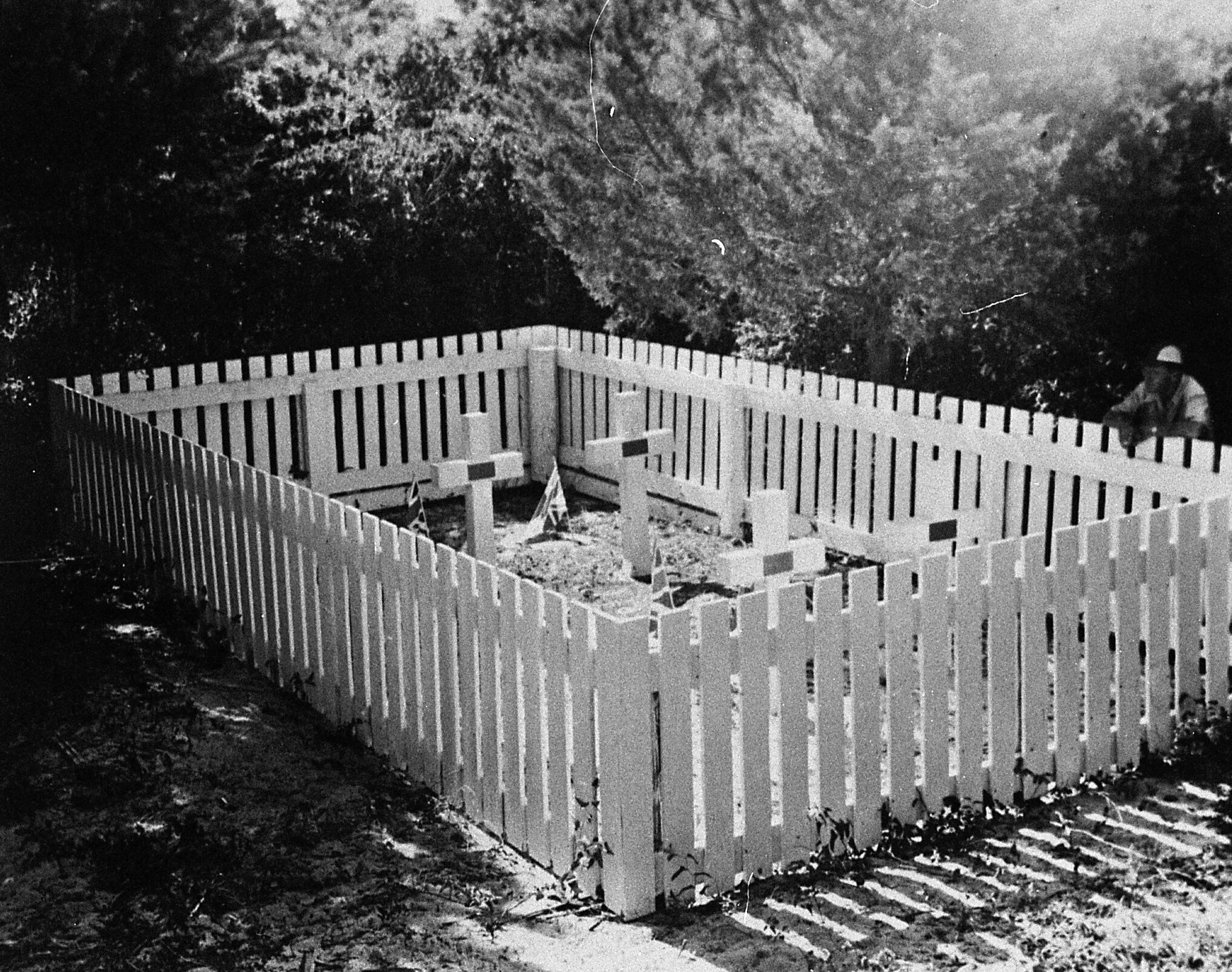 The British Cemetery at
Ocracoke
The British Cemetery at
OcracokeThe
tiny British graveyard on Ocracoke Island contains four graves, two of which are
marked “Unknown.” A third bears the name of Lt. Thomas Cunningham,
and the fourth that of Stanley R. Craig, A.B. The words “Royal Navy”
and “Body found May 14, 1942” are inscribed on all four of the
bronze plaques on concrete crosses erected at the time of burial. All bodies are
identified as members of the crew of HMS Bedfordshire which disappeared with all
aboard en route from Norfolk to Morehead City, its temporary “home”
port. Rites at Ocracoke were held by the late Amasa Fulcher, prominent layman of
the local Methodist Church. A year later, at Mrs. Cunningham’s request, a
Catholic service was held by the Navy chaplain, then stationed at Ocracoke. Land
for the British burials was given by Mrs. Alice Wahab Williams near the Williams
family graveyard. Markers were made by the T.A. Loving Construction Co., then
building the Navy base nearby. A commemorative service
is held each year in May.
If you would like more information on Ocracoke please see Ocracoke Village Site and Ocracoke Navigator
